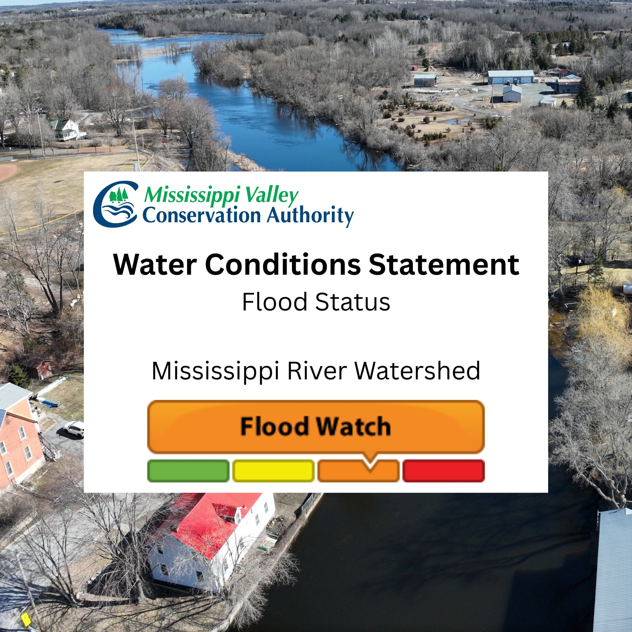
Flood Watch Continues for Mississippi River Watershed – April 20, 2026
From the Mississippi Valley Conservation Authority
A Flood Watch Statement indicates that flooding is possible in specific watercourses or municipalities. Municipalities, emergency services and individual landowners in flood prone areas should prepare.
This is an update to the Flood Outlook Statement for the Mississippi River watershed issued April 13, 2026.
Weather forecast
Conditions are expected to stay generally dry this week. Cumulative total rainfall over the next seven days (Monday to Sunday) is expected to remain low, with less than 20mm across the region forecasted for the weekend. Air temperatures are cooler today and tomorrow but warming up again later in the week with forecasted daily highs around 15°C.
Watershed conditions
Water levels and flows are elevated across the watershed as a result of the recent consecutive days of rainfall and warm temperatures which depleted the remaining snowpack and increased runoff. Ground conditions are saturated and have little ability to absorb further rainfall.
Upper lakes, including Mazinaw, Kashwakamak, Big Gull, Mississagagon, Little Marble, and Marble, remain in seasonal flood conditions. Water levels have peaked and are expected to begin gradually receding this week. Along the Mississippi River, water levels and flows are expected to continue rising as water moves through the system. Flood-prone areas, such as Dalhousie Lake and Mississippi Lake, may experience elevated water levels consistent with seasonal conditions.
Major tributaries, including the Indian River, Clyde River, and Fall River, have peaked and levels and flows along these systems will start to recede this week.
Risks
Rivers and streams are experiencing higher water levels, fast flowing water and slippery or unstable banks. Roads, driveways, and properties in flood-prone areas could be impacted with localized ponding or minor flooding.
Actions
Residents are advised to exercise caution when near rivers, streams, and other waterbodies due to high flows and slippery conditions. Parents are encouraged to remind children about these dangers and provide appropriate supervision.
Residents in flood prone areas are advised to maintain close watch on water levels and flows and take the necessary precautions to protect their property by:
- Ensuring sump pumps are clear, in good working condition and have a backwater valve.
- Having a portable generator and backup pump available.
- Ensuring downspouts are clear and the outlet is at least 3 metres from any structure.
- Removing or securing items that might float away if flows increase.
- Removing valuable items from basements or lower floors that could be subject to flooding.
- Keeping emergency phone numbers handy.
- Familiarizing yourself with your Municipality’s emergency preparedness plan – Mississippi Mills Emergency Response Plan.
Duration
This message is in effect until April 28, 2026, or until an update has been issued.
For more information
Daily water levels and flows are available on the MVCA website at www.mvc.on.ca/water-levels.
For more information, contact MVCA Water Management at 613-253-0006 ext. 248 or water-management@mvc.on.ca.
Sign up to our newsfeed
Stay up to date on the municipality's activities, events, programs and operations by subscribing to our daily news digest